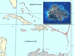
Antigua is located in
the middle part of the Leeward Islands in eastern
Caribbean. To east is the Atlantic Ocean and to the
west is the Caribbean Sea. The following is the
initial compilation of digital maps of Antigua. If you are
new to GIS,
click here (What is GIS?) to read a
document that introduces the basic concepts in
Geographic Information System (GIS).
Click on the picture to access the
interactive user interface to view the maps. For more information, please write to
[email protected].
Metadata files for each layer are available upon
request.
[Click on the picture to
access]
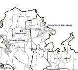
Visitor's Map
This
is an easy to read map describing roads, populated
places, places of interest and local legal
boundaries called parishes. These map layers can be
overlaid with a geo-referenced Tourism Map published
by the Department of Tourism, Landsat ETM+ satellite
imagery, and digital elevation (DEM) maps.
[Click on the picture to
access]
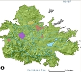
Environmental Map
This
is a collection of terrestrial-themed digital layers
including inland water bodies (drainage, water
bodies and watersheds, and PGDM flood zones),
mangrove locations, hypsographic features (e.g.,
hills, points cliffs), and other physical features
of Antigua. The layers can be overlaid with
satellite images, and elevation maps of Antigua.
[Click on the picture to
access]
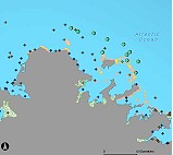
Coastal Ocean Map
This
is a compilation of coastal ocean based digital
layers including hydrographic features (e.g., bays,
harbors and channels), living resources such as
coral reefs and mangroves, and ocean depth (GEBCO).
This map also contains the summarized site data for
the Antigua AGRRA coral reef and fish survey
conducted by NCORE in August 2005.
[Click on the picture to
access]
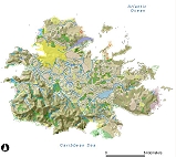
Landuse Map
This
is a land use map of Antigua. The landuse data in
this map were created for the
Post-Georges Disaster Mitigation Project
implemented by the Organization of American States,
Unit for Sustainable Development and Environment.
The map classifies all land features in Antigua
according to the following scheme: airport,
industrial, military use, landfill, urban
settlement, tourism, recreational/historical area,
agriculture, citronella field, improved pasture,
mixed scrub and/or rough grazing, woodland,
swamp/mangrove, fresh water, and salt water ponds.
Other links of
Interest
For more information on
these links, please contact:
Click on the links below to
access the files. For slow internet connections, it
is advisable to download a copy before viewing the
animated files (for Windows Internet browser,
right-click and select "Save Target As..." to
save a copy to a local directory):
Animated GIF
showing the circulation in Belize reefs (GIF
~40.5MB; courtesy of Laurent Cherubin).
Animation of
virtual larvae released at spawning sites from
the mutton snapper in Cuba (MOV
~3MB;
MP4 ~1.4MB; courtesy of Claire B. Paris)
Eastern
Caribbean circulation model (AVI
~ 16.8MB; courtesy of Zulema Garaffo)
Copyright 1999-2004,
NCORE University of Miami - RSMAS. All Rights Reserved.


 Digital Maps/GIS: Antigua