|
Improving the success of
coral reef management requires a greater understanding of the
interactions between coral reef resources and their users.
Coral reefs are complex, nonlinear systems in which the interplay of
spatial heterogeneity and stochastic events with environmental
factors results in highly variable patterns of resource availability
and use. Because it is difficult to capture this interplay in
differential equation models of environmental or fishery dynamics,
it is reasonable and useful to apply approaches developed
specifically for studies of complex systems, such as agent-based
models. The development of a Geographic Information System (GIS) to
describe the spatial distribution of the data is an important
initial step toward the realization of scenario testing tools to aid coral reef
management.
Click here to open a simple to read
a document that introduces the basic concepts
in Geographic Information System (GIS).
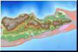
 St.
Croix and Buck Island Data Navigator St.
Croix and Buck Island Data Navigator
{Click
here to see the collections from
LOF website} |
The St. Croix and
Buck Island Data Navigator
is an Internet-based Geographic
Information System (GIS) developed
in support and partnership with
Living Oceans Foundation.
The Data Navigator was
designed to facilitate access and
analyses of spatial data for St.
Croix and Buck Island (USVI) with
the goal to minimize the need for
specialized GIS training in order
for resource managers and others to
use the GIS to full advantage while
also maximizing the efficiency at
which to conduct their research. |
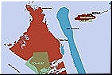
Antigua
and Barbuda: Collection of Digital Maps
{Click
here to see the collections} |
Earlier in August 2005, NCORE was
invited to conduct a
coral reef survey in the North
Sound region of Antigua, B.W.I. This
survey was supported by the
Stanford Development Corporation
and was performed using the benthic
and fish surveying methods of the
Atlantic and Gulf Rapid Reef
Assessment (AGRRA) program. The
Stanford Development Group along
with Antiguan officials have begun
discussions of long term
collaboration toward an integrated
coastal management project for the
small island nation. This
internet-based Antigua GIS was
established in order to showcase
some of the potential outcomes of
project integration, data sharing
and cooperation among stakeholders. |
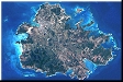
Data
Navigator: South Florida (formerly FK GiDST)

{Click
here to load
DNav: South Florida}
|
While GIS offers great potential for assisting resource managers, it
has been avoided by some and inefficiently utilized by others. There are
hundreds of digital maps available to managers and most data can be
downloaded via the Internet. However, in many of these cases, the
expertise or skills required to access the proper digital maps is not usually readily available.
NCORE has
initiated the development and
deployment of an Internet-based
system to help resource managers
navigate through a maze of publicly
available digital maps for Florida
Keys (here called, DNav: South Florida; formerly labeled as FK GiDST). This
Internet-based system was officially launched during the Coral Reef Task Force
Meeting (2-3 Dec 2004, Miami, FL). |
Bahamas
Online Digital Map Atlas
{Click
here to load
Bahamas Online Digital Map Atlas}
|
The
Bahamas Biocomplexity Project (BBP), led by
CBC Marine Program Manager
Dan Brumbaugh, with collaborators from
nine different institutions have
identified the areas of research
needed (both theoretical and empirical) in
developing an integrated study of the
design, implementation, and management of an MPA network. As part of the Geographical
Information System (GIS) working group,
NCORE is developing an online digital map
atlas of the study area to address the
spatial integration of the human dimensions
with the biophysical patterns and processes
being studied by the other working groups.. |
Hawaii
VRML
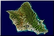
{Click
here to load
Hawaii VRML files}
|
The
Hawaii VRML (Virtual Reality Markup
Language) page is a demonstration page that
takes a digital elevation map to the next
level of utility. Used in conjunction with
some Agent-based Modeling (ABM) activities
of NCORE, users can zoom, tilt, pan the 3D
map. Please note
a
VRML Internet browser plug-in is required
for this page.
Click here to download the required
utility. |
|
|